The phrase Karachi beach hides more than it reveals. The city's coastal edge includes a working harbour engineered for large vessels, urban parks facing the open sea, tidal creeks with shifting margins and exposed sandy shores. These places share salt water but not the same purpose, access, ecology or risk.
This feature is entirely ashore-only. It does not recommend swimming or water entry; anyone contemplating entry must obey current authorities and qualified lifeguards, and should remain out when clear permission and supervision are absent.
At a glance
Start here
- Harbour, promenade, creek and exposed shore are different coastal systems.
- Charts and tide tables show that official agencies map these waters at different scales.
- Urban park access does not establish water safety or continuous coastal access.
- A responsible coastal visit begins with purpose, current information and a firm ashore boundary.
01
The harbour is partly made water
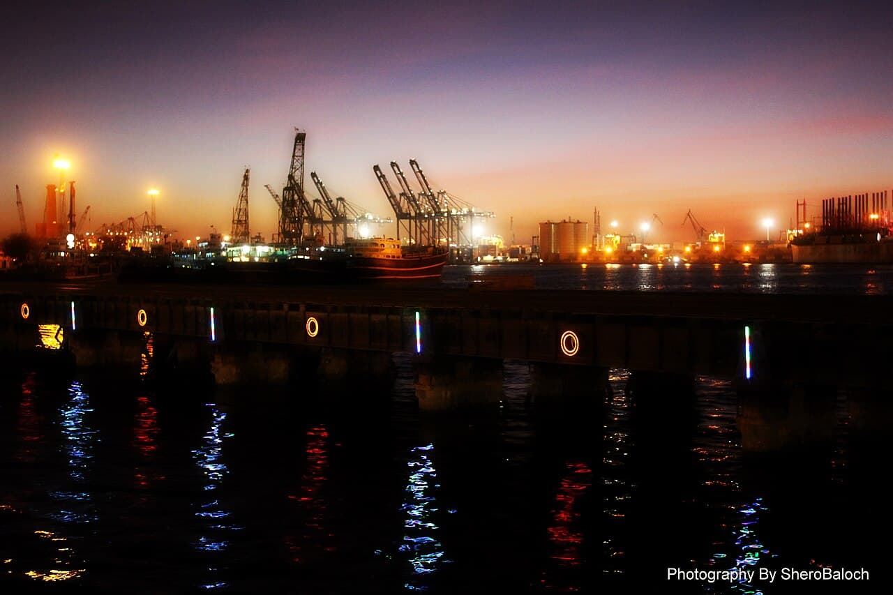
Karachi Harbour's present form is not simply a natural inlet discovered intact. KPT's history records channel dredging, a mole, Manora breakwater, Keamari Groyne, bridges and successive wharves. This is water organised for navigation and transfer. A harbour view therefore contains engineering decisions even when the structures are distant or invisible. It also contains operational boundaries. Port land, jetties, channels and breakwaters should never be treated as improvised public viewing platforms; use only lawful, clearly authorised ground. The historical sequence explains the harbour's made form without implying that any of its working structures are open to visitors.
Sources: Karachi Port Trust02
The Clifton edge is civic space
The Clifton promenade shifts attention from water to land: paths, gathering space and the relationship between an open horizon and dense city. Its presence does not mean the coast is fully accessible, maintained to a single standard or safe for entry. The experience is about being beside the sea while remaining within a civic landscape. Its most revealing contrast may be behind the viewer, where roads and buildings show how Karachi frames the shoreline for public use. Current municipal and on-site directions control where that use is permitted, so verify the exact access point rather than treating the whole edge as continuous public space.
03
Creeks complicate the line between land and sea
The National Hydrographic Office publishes a chart titled Ghizri Creek and Approaches to Korangi Creek, separate from Karachi Harbour and Approaches to Karachi. Even without using a nautical chart as a visitor map, the distinct titles establish that the coastal system contains creek approaches requiring their own scale and navigation information. A creek margin can expose mud, channels or vegetation differently as water levels change; it is not an inferior version of an open beach. Observe from authorised land and do not cross mudflats, drainage channels, mangrove margins or private fishing infrastructure. A visually shallow edge can still be unstable, tidal or operational.
Sources: National Hydrographic Office Pakistan04
An exposed shore carries no promise
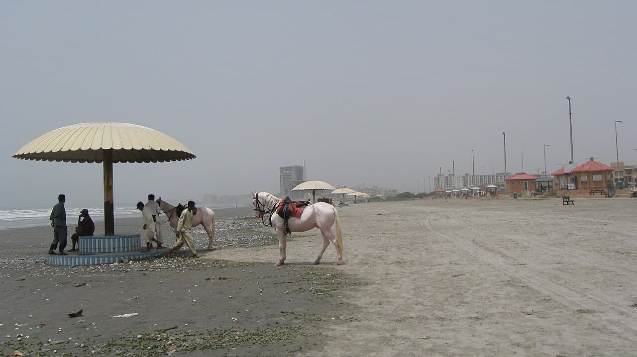
A sandy western shoreline may appear more natural than a harbour or promenade, but appearance cannot establish access, rescue coverage, currents, road condition or environmental sensitivity. Maritime warnings and local restrictions change by date and location. Plan an exposed-shore visit only as an ashore stay in a currently authorised area. Bring shade, drinking water and a charged phone according to personal needs, take all waste away and keep a generous distance from the waterline. No season, crowd size, photograph or calm surface turns this article into permission to swim. If current local information is incomplete, choose the urban land-based fallback instead of filling the gap with assumptions.
Sources: National Hydrographic Office Pakistan05
Tide is a dimension, not a rating
The official tide table provides daily predictions for high and low water, hourly heights, seasonal mean-sea-level variation and statistics for Karachi Port. Tide changes how much shore, wall or creek margin is visible. It does not produce a green or red safety rating for a visitor. Predictions are tied to locations and datums, so a Karachi Port table should not be casually applied to every distant beach. Use tide information to interpret photographs or plan what might be visible from a legal viewpoint, never to justify walking onto a lower ledge or entering water. Weather, waves, access and local instructions remain separate.
Sources: National Hydrographic Office Pakistan06
Warnings reveal a maintained system
The National Hydrographic Office's coastal-warning list includes changing notices about buoys, wrecks, lights and operations in Karachi approaches and the wider Arabian Sea. The details are for navigation, yet their constant revision reveals something larger: the coast is actively monitored and never static. Navigation aids move or fail; objects are lost; work begins and ends. Visitors should not use those notices as a beach-clearance service, but they should abandon the idea that yesterday's coastal description remains automatically true. Check current official information and on-site restrictions for the actual place, then stay on land behind all barriers.
Sources: National Hydrographic Office Pakistan07
Ask four questions before saying beach
First, what kind of edge is this: harbour, promenade, creek or exposed shore? Second, who manages the land where you intend to stand? Third, which current forecast, warning or restriction applies to that exact outing? Fourth, what is the ashore fallback if access changes? These questions replace the vague search for Karachi's best beach with a more accurate choice. A family seeking open civic space may choose Clifton; a student of infrastructure may study the harbour from lawful public ground; a landscape observer may focus on creek form. None requires entering the water, and none should be promised wildlife, solitude or unrestricted access.
Useful answers
Reader questions
Why not call all of it Karachi beach?
Because official records distinguish engineered harbour works, charted approaches and creek systems. Their physical form, management and use differ substantially from an exposed sandy shore.
Sources: National Hydrographic Office Pakistan; Karachi Port TrustDoes low tide make the shore safe to walk?
No. A tide prediction concerns water level, not ground stability, waves, pollution, access or rescue coverage. Stay on authorised land.
Sources: National Hydrographic Office PakistanIs this article recommending water activity?
No. It is ashore-only. Anyone considering entry must follow current authorities and qualified lifeguards, and remain out without explicit current permission and supervision.
Sources:What should I check on the day?
Check current official weather and sea information, local access restrictions and every on-site direction for the exact location. Cancel if those sources are unclear or restrictive.
Sources:Read the evidence
Sources and further reading
These sources support the relevant sections above. Plans and comparisons are editorial suggestions. Check operators for current arrangements.
- KPT History ↗Karachi Port Trust · Accessed 14 September 2026
Historic engineering that shaped Karachi Harbour.
- CHARTS LIST ↗National Hydrographic Office Pakistan · Accessed 14 September 2026
Distinct chart coverage for harbour, approaches and creek systems.
- TIDE TABLE ↗National Hydrographic Office Pakistan · Accessed 14 September 2026
The contents and location-specific nature of Karachi Port tide predictions.
- COASTAL WARNINGS ↗National Hydrographic Office Pakistan · Accessed 14 September 2026
The changing official list of maritime navigational notices.