Karachi's shore is best planned as a set of different viewing environments, not one continuous beach. An urban promenade, a harbour edge, a creek margin and an exposed sandy coast reveal different relationships between city and sea. This guide stays entirely ashore and helps you choose a viewpoint without turning tides, marine forecasts or nautical warnings into a promise of personal safety.
No swimming or water entry is recommended. Anyone contemplating entry must follow current authorities and qualified lifeguards, and a lack of clear, current supervision means staying on land.
At a glance
Start here
- Choose the coastal type first: promenade, harbour, creek or exposed shore.
- Check PMD forecasts, Navy hydrographic information and local authority notices on the day.
- Tide data changes what is visible but never proves a place is safe for entry.
- Keep the visit ashore, behind barriers and outside operational port areas.
01
Start with four kinds of shore
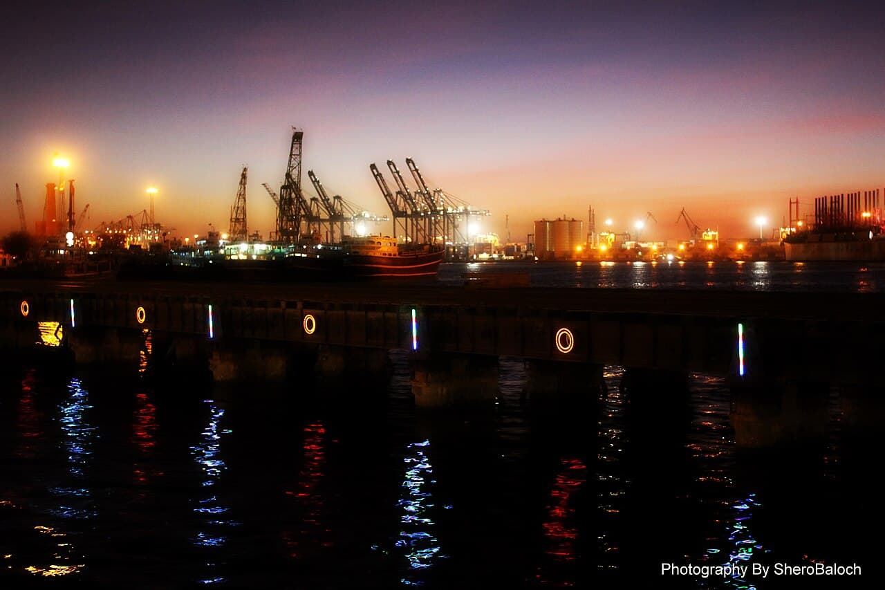
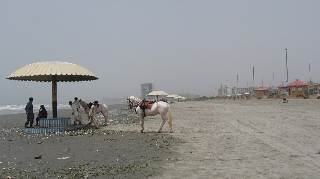
Use four categories to make the first decision. Clifton offers an urban seafront with a built promenade and city backdrop. Karachi Harbour is a working maritime system of wharves, terminals, oil piers and navigation channels, not a casual beach. Ghizri and Korangi are creek landscapes, identified separately in the National Hydrographic Office chart list. The western sandy coast is more exposed and requires its own current access and authority checks. These categories are deliberately broad: choose one experience instead of assuming that a photograph labelled Karachi coast tells you where you can stand or what conditions will be like.
Sources: Karachi Port Trust; National Hydrographic Office Pakistan02
Choose Clifton for an urban horizon
Choose the Clifton side when the aim is a broad horizon with a city setting and a land-based fallback. Verify current access, cleanliness, lighting, parking and accessibility locally rather than assuming the promenade has a fixed standard. Frame the outing around walking or sitting on authorised land, watching the light change and comparing the open sea with the built edge behind you. Do not move onto wet sand, rocks, drainage channels or temporary structures to improve a photograph. A visible crowd is not an official safety signal, and calm-looking water is not permission to enter it.
03
Read the harbour from lawful public ground
Karachi Harbour is visually valuable because it shows infrastructure: terminals, berths, warehouses, navigation aids and the separation between land logistics and ship movement. KPT's overview describes East, West and South wharves, three container terminals, three oil piers, warehousing and dredging. Observe only from clearly public, authorised ground. Do not enter a gate, jetty, breakwater, restricted road or industrial edge for a closer view, and do not present a commercial port as a public attraction. If the legal viewing position is unclear, choose a different shoreline type. A working harbour should be understood through its transfer systems without becoming an improvised visitor zone.
Sources: Karachi Port Trust04
Use tides to understand the scene
The National Hydrographic Office publishes annual Karachi Port predictions with daily high- and low-water times, hourly heights, seasonal mean-sea-level variation and tidal statistics. That information can explain why a mudflat, harbour wall or strip of sand looks different at two times of day. It cannot certify a viewpoint, walking route or water entry as safe. Read the current table as environmental context, then obey barriers and local instructions. Never descend to a lower ledge because a predicted level appears favourable: waves, drainage, vessel movement, wind and local restrictions are separate variables not resolved by a tide number.
Sources: National Hydrographic Office Pakistan05
Check weather before chasing light
A sunset plan should begin with the Pakistan Meteorological Department, not a social-media forecast. PMD publishes time-specific sea bulletins, but the visible archive can lag; confirm that the document you are reading is current and clearly time-stamped. Wind, poor visibility, rain, extreme heat or a marine advisory are reasons to shorten, relocate or cancel an exposed stop. An indoor museum or sheltered urban plan is a successful substitute, not a failed coastal day. Do not infer shoreline safety from a general city forecast alone, and let specific authority restrictions override a broader forecast or an appealing patch of sky.
- Check publication time and forecast validity.
- Separate a city forecast from a marine bulletin.
- Cancel when current authorities restrict coastal access.
07
Build an observation sheet, not a checklist
At a lawful viewpoint, record five things: shoreline material, water movement, human use, visible infrastructure and the direction of the city behind you. On the promenade, the built edge may dominate; near the harbour, cranes and navigation structures may explain the view; near a creek, the boundary between water and land may appear less fixed. Keep people, working vessels and security installations out of intrusive close-up photography. Leave no food, plastic or fishing line. This observation method makes a short ashore visit useful without promising a perfect sunset, rare wildlife, empty space or access to a named feature.
Useful answers
Reader questions
Does this guide recommend swimming?
No. Every recommendation is ashore-only. Anyone contemplating water entry must follow current authorities and qualified lifeguards; without explicit current permission and supervision, stay out of the water.
Sources:Can a tide table tell me when a beach is safe?
No. The official table predicts water levels for specified locations. It does not assess access, surf, currents, pollution, weather or lifeguard coverage.
Sources: National Hydrographic Office PakistanCan I walk into Karachi Port for a better view?
Do not enter operational or restricted port land. View the harbour only from clearly public, authorised ground and follow security instructions.
Sources: Karachi Port TrustWhich forecast should I check?
Check PMD's current city forecast plus its time-stamped sea bulletin where relevant, then look for current local restrictions and on-site instructions.
Sources: Pakistan Meteorological DepartmentRead the evidence
Sources and further reading
These sources support the relevant sections above. Plans and comparisons are editorial suggestions. Check operators for current arrangements.
- Overview of Karachi Port ↗Karachi Port Trust · Accessed 14 September 2026
The operational structure of Karachi Port, including wharves, terminals and oil piers.
- CHARTS LIST ↗National Hydrographic Office Pakistan · Accessed 14 September 2026
Separate chart coverage for Karachi Harbour, Karachi approaches, Ghizri Creek and Korangi Creek.
- TIDE TABLE ↗National Hydrographic Office Pakistan · Accessed 14 September 2026
The scope and components of annual tide predictions for Karachi Port.
- COASTAL WARNINGS ↗National Hydrographic Office Pakistan · Accessed 14 September 2026
The purpose and changing content of coastal navigational warnings.
- Sea Bulletin ↗Pakistan Meteorological Department · Accessed 14 September 2026
The existence of time-specific official sea bulletins; no archived bulletin is asserted as current.